

Aerial Services
In a world driven by visual content, a ground-level view is no longer enough. At CR Aerial Services, we provide high-definition aerial cinematography and photography that captures the full scale, beauty, and context of your project. From luxury real estate and community events to cinematic marketing for the Maine tourism industry, we bring your vision to life from the clouds.
Our Technology: Professional Visual Systems
Our fleet is equipped with state-of-the-art stabilized cameras designed to deliver crisp, professional results in any environment.
Cinematic 4K UHD Video: Smooth, high-bitrate footage that’s ready for the big screen or a high-impact social media campaign.
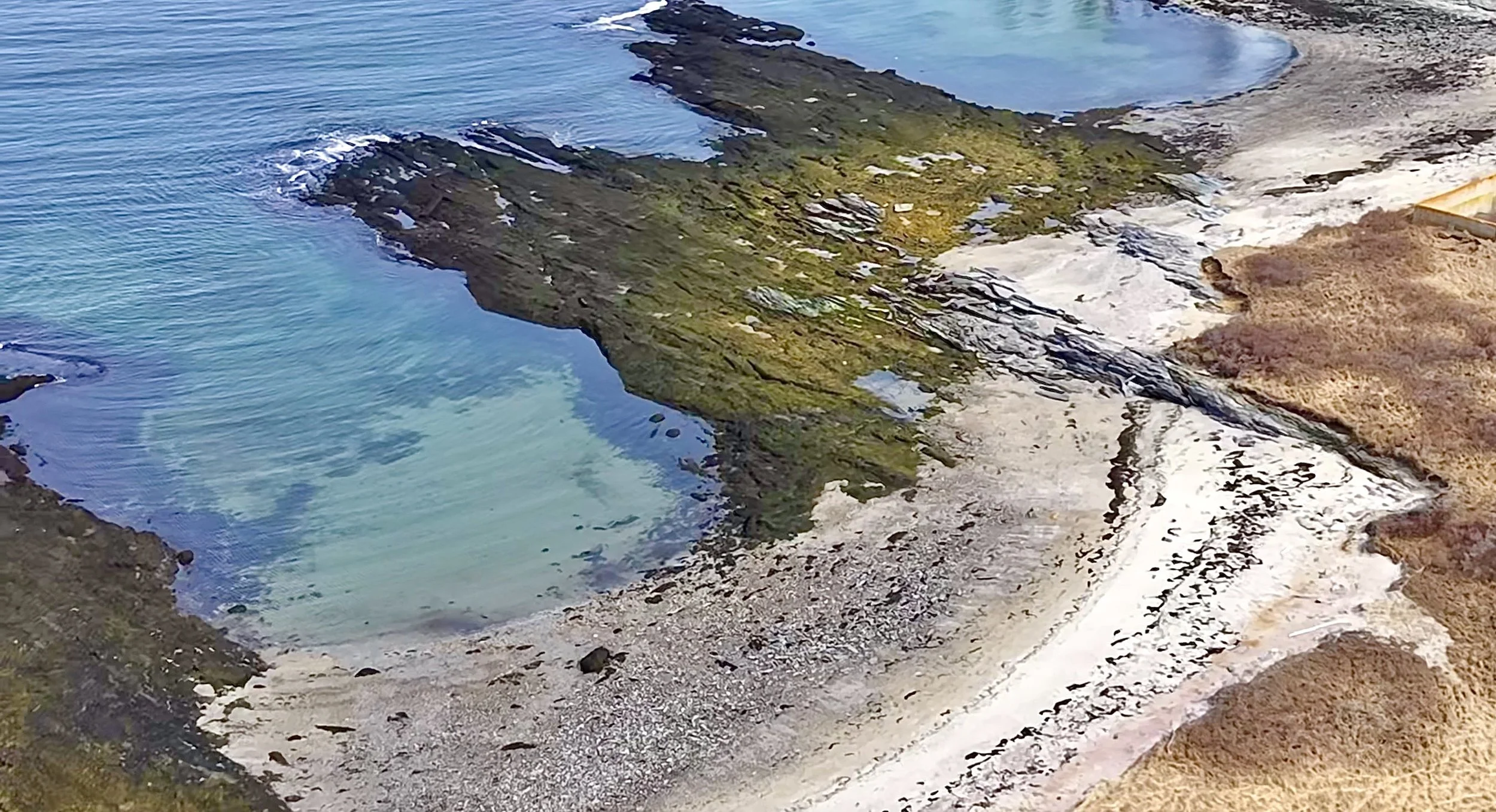
Ultra-High-Res Stills: 48MP imagery with 112x hybrid zoom, allowing us to capture stunning detail from a safe and non-intrusive distance.
Low-Light Excellence: Advanced sensors and Night Scene modes ensure your project looks its best, even during the "golden hour" or after dark.
The "Live View" Ground Station: Don't wait for the edit. Our Mobile Command Center allows you to stand with our pilots and see a live 4K feed of what we’re capturing, ensuring we get the exact shot you need before we land.
📸 The Possibilities: General Aerial Services
Real Estate (Commercial & Luxury): Showcase full property layouts, neighborhood context, and scenic views. Listings with aerials sell faster and attract higher-quality leads.
Construction Progress: Provide consistent, high-resolution site updates, offering stakeholders a "birds-eye" view of milestones, logistics, and site safety from start to finish.
Events & Festivals: Capture the true scale of outdoor weddings, festivals, and corporate retreats. Our drones deliver dynamic, sweeping shots that ground cameras simply can't reach.
Tourism & Marketing: Promote the beauty of the Maine coast, resorts, or outdoor attractions with cinematic "hero shots" that grab attention and boost engagement.
Asset Documentation: Create high-res visual records of roofs, towers, and hard-to-reach structures for insurance, archival, or marketing purposes.
Community & Municipal: Document land use, park developments, and municipal projects with precise orthomosaic mapping and visual surveys.