

WHAT TO EXPECT: YOUR MISSION JOURNEY
At CR Aerial Services, we don’t just "take pictures." We deploy advanced aerial and underwater intelligence systems to solve complex problems. Here is the step-by-step journey of a typical mission, from the first consultation to the final data delivery.
THE CONSULTATION & TECH-SPEC
Every project begins with a deep dive into your goals. Whether you need a thermal audit of a solar farm or a structural inspection of a submerged pier, we define the Technical Deliverables you need.
The Result: You receive a detailed estimate and a project retainer request to lock in your mission date.
PRE-MISSION INTEL (BEHIND THE SCENES)
Once the retainer is confirmed, our work starts in the office.
Compliance: We secure FAA airspace authorizations (LAANC) and verify any local municipal requirements.
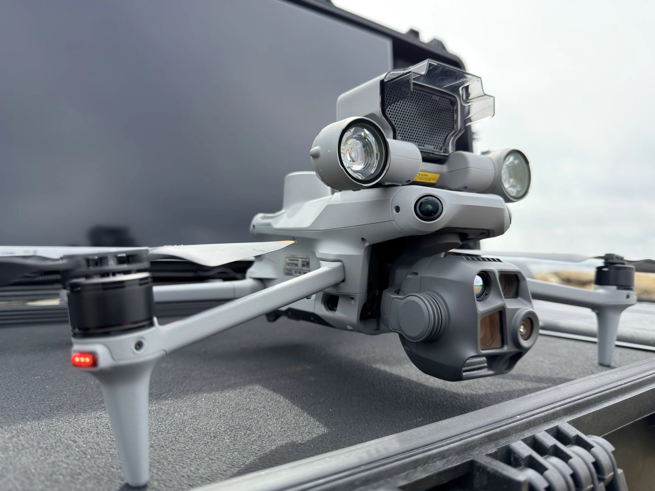
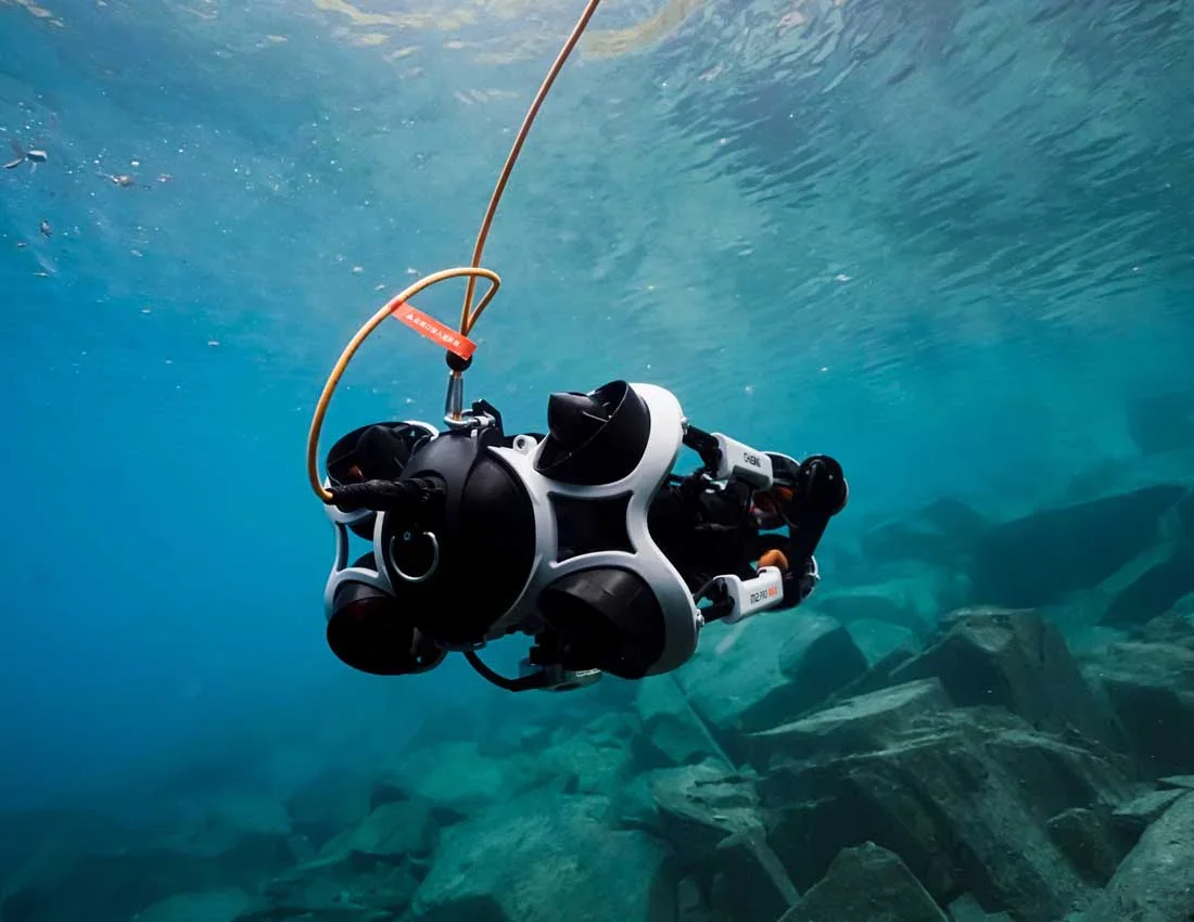
Calibration: We prep the DJI Matrice 4T or Chasing ROV, ensuring all thermal, optical, and depth sensors are calibrated for the specific environment—whether it's the rugged Maine coast or an inland industrial site.
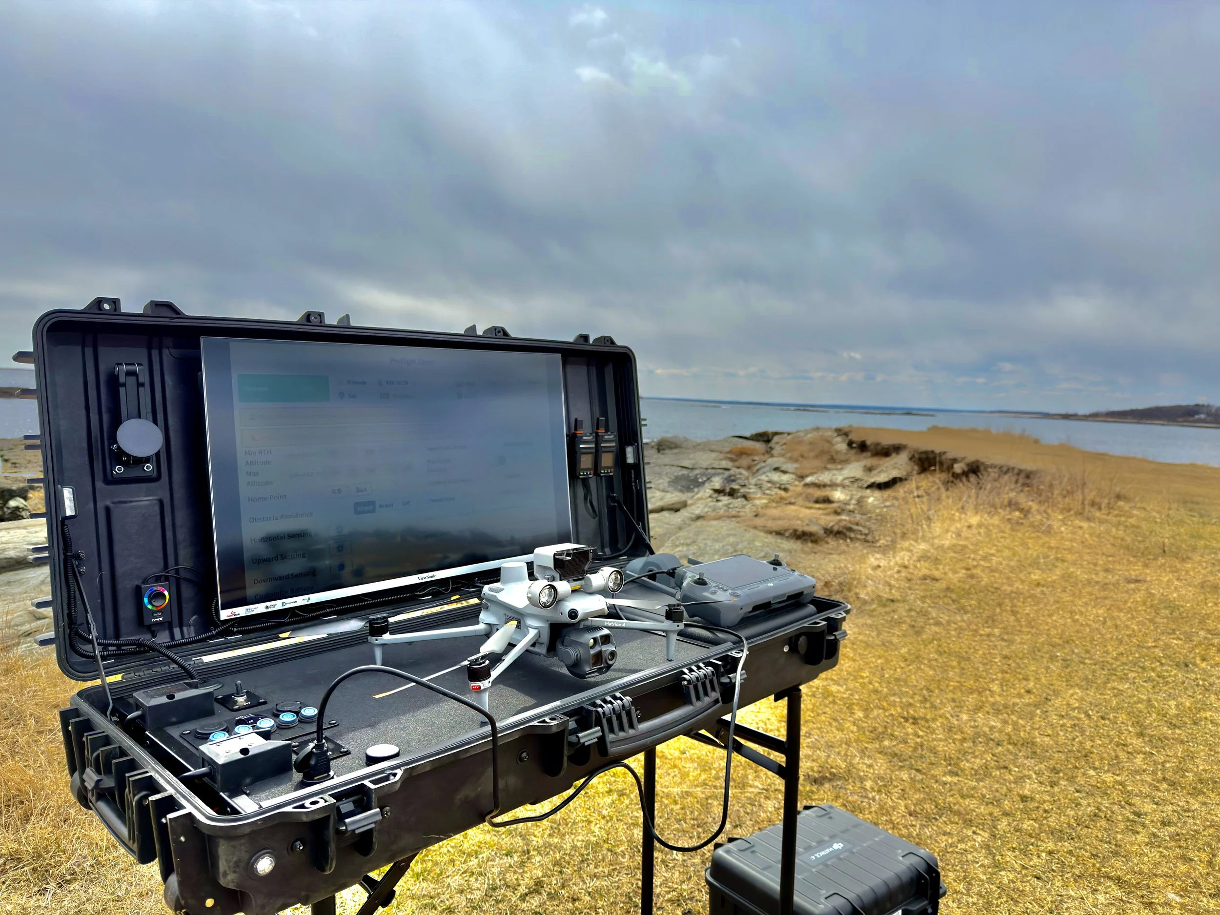
DEPLOYMENT: THE MOBILE COMMAND CENTER
On mission day, we arrive with our Mobile Command Center. This isn't just a van; it’s a high-tech hub designed for precision.
The Experience: You are invited to join our team inside the Command Center.
Live 4K Feed: You will see exactly what the UAV or ROV sees on high-definition monitors in real-time. This allows you to direct our pilots to specific areas of interest as they appear, ensuring no detail is missed.
Safety First: We establish a "sterile perimeter" for takeoff and landing to ensure the safety of all personnel and property on-site.
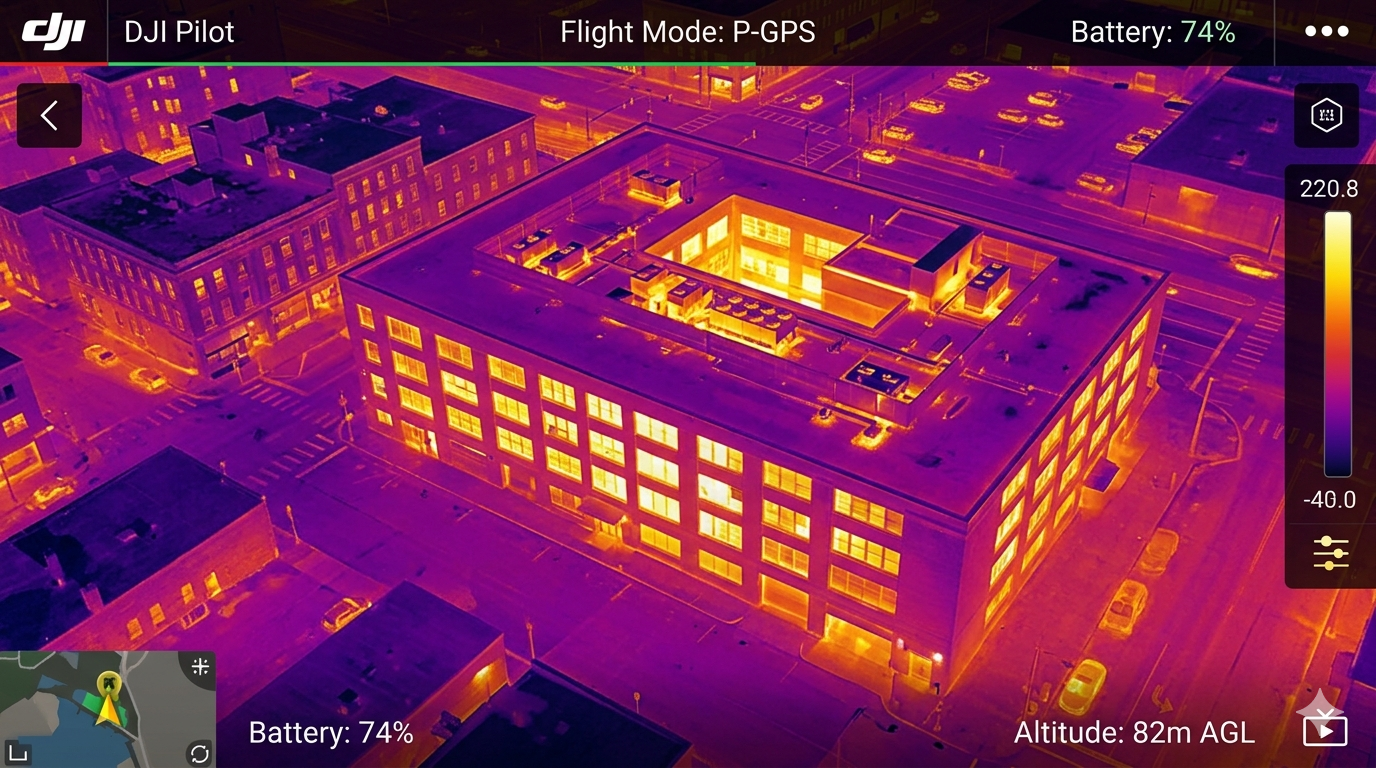
DATA HARVESTING & ANALYSIS
After the flight or dive, the "raw" data is only half the story.
Processing: For thermal missions, we process the heat-signature data to identify anomalies. For mapping, we stitch images together to create high-res orthomosaics or 3D models.
Quality Control: We verify every frame and data point for clarity and accuracy before it ever reaches your inbox.
SECURE DELIVERY & DATA OPTIONS
Upon project completion, you will receive a secure link to your digital "Mission Folder." Please note that the specific contents and delivery timeline are contingent upon your unique project scope.
What’s Inside: Depending on your project, this includes 4K cinematic video, high-res stills, thermal heat maps, or detailed structural reports.
Raw Media Requests: While edited highlights are standard, we can provide unprocessed raw images or unedited sensor data upon request. Due to the high volume of data and specialized transfer protocols required for enterprise-grade files, an additional fee will apply for raw data delivery.
Timeline: Most standard visual data is delivered within 48 hours. Complex technical mapping or ROV inspections typically arrive within 3–5 business days to allow for proper data rendering and analysis.
Showcasing Your Success: We are proud of the work we do for our clients. Unless otherwise requested, we may share a "hero shot" or a cinematic highlight from your mission on our official social media channels or portfolio. This not only showcases your project from a world-class perspective but highlights the cutting-edge technology (UAV/ROV) being used on your site. If your project requires 100% confidentiality, just let us know before we take flight!
THE "MAINE FACTOR" (A NOTE ON WEATHER)
We work in a state known for its unpredictable elements. If we wake up to 30mph winds or a classic Maine "sea fog," we prioritize the safety of your project and our equipment.
The Guarantee: If we have to ground the mission for weather, we will stay in constant contact and move your project to our next available clear-weather window—at no extra cost to you.